- Seeing is Selling
- Posts
- How to Pick the Right Views for Your Project... in 5 Minutes.
How to Pick the Right Views for Your Project... in 5 Minutes.
The wrong angles can lead to delays. The right ones build momentum.
Ed Griffiths
August 01, 2025
The success of any development project depends on how well it’s presented to its audience. Using the right image or visual tool ensures your stakeholders see your vision clearly, whether it's for planning approval, public consultation, or marketing.
The Problem
When the wrong type of visual or view is chosen, it can create confusion, resistance, or outright rejection. Different audiences have different concerns and priorities. Using the wrong perspective for your visuals can misalign expectations, alienate stakeholders, or fail to communicate the true potential of your project.
For instance, an aerial image that highlights the scale and positioning of a massive industrial park might appeal to investors but could unnecessarily alarm local residents. Conversely, a detailed internal view of a commercial space might excite potential tenants but is unlikely to address planning concerns.
"There are always two people in every picture: the photographer and the viewer"
Ansel Adams
Choosing the wrong perspective can lead to costly consequences:
Planning Challenges: A single poorly chosen image could invite objections from local residents or fail to satisfy the planning authority, leading to lengthy delays.
Marketing Shortfalls: Without the right visuals, your development risks being overshadowed by competitors who better communicate their value to buyers and investors.
A tailored approach to visualisation is critical. Every stakeholder - whether planning authorities, local communities, or prospective buyers - has unique needs. By aligning your visuals to their priorities, you ensure your project is well-received at every stage.
The Solution
Our expertise lies in creating visuals that align perfectly with your audience’s expectations. Here’s how different types of images can support your goals:
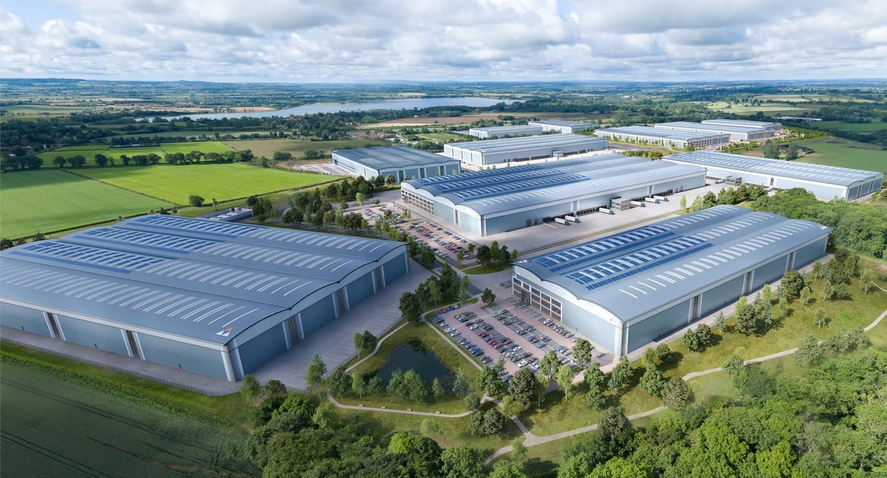
Aerial Views
Modern, sustainable, superbly connected. Aerial view for Valor | © Blink Image Limited
Purpose: Showcase the development’s position and relationship to its surroundings.
Best For: Marketing, emphasising the scale and strategic location.
Considerations: Aerial views are fantastic for presenting a sense of place, but they can exaggerate the perceived scale of large developments, potentially alarming planning authorities or local residents.
Technical Needs: Typically captured with fixed-wing photography (airplane).
Example: An aerial shot of a multi-unit logistics park highlights its proximity to major transport routes, drawing the attention of investors. However, for a public consultation, it may need to be balanced with images that emphasise human-scale perspectives to re-focus on actual benefits the development will bring (employment or investment for example).
High-Level Views
High-Level drone view for Tritax Big Box | © Blink Image Limited
Purpose: Close enough to capture details while distant enough to convey the overall scale.
Best For: Marketing, offering a comprehensive overview of the development.
Considerations: These images might intimidate local residents, as the scale can feel imposing. Often captured using drones.
Example: A high-level view of a high-end logistics development showcases its layout, green spaces, and proximity to local amenities and neighbouring green spaces, making it ideal for brochures or investor pitches.
Low-Level Views
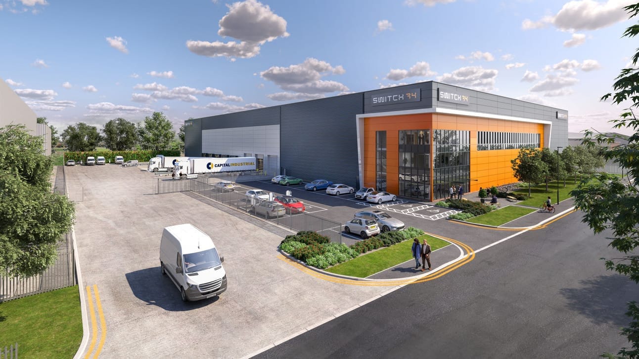
Low-Level drone view for Capital Industrial’s Switch 74 | © Blink Image Limited
Purpose: Focus on detailed elements, providing glimpses of life around the buildings while maintaining a broader perspective.
Best For: Both marketing and planning, as they offer a balanced, accessible viewpoint.
Considerations: Slightly elevated positions help avoid foreshortening and provide clarity in details like car parks and landscaping.
Example: A low-level image of an industrial unit highlights thoughtfully designed parking and yard areas, as well as the extensive green space appealing to potential tenants and reassuring planners.
Eye-Level Views
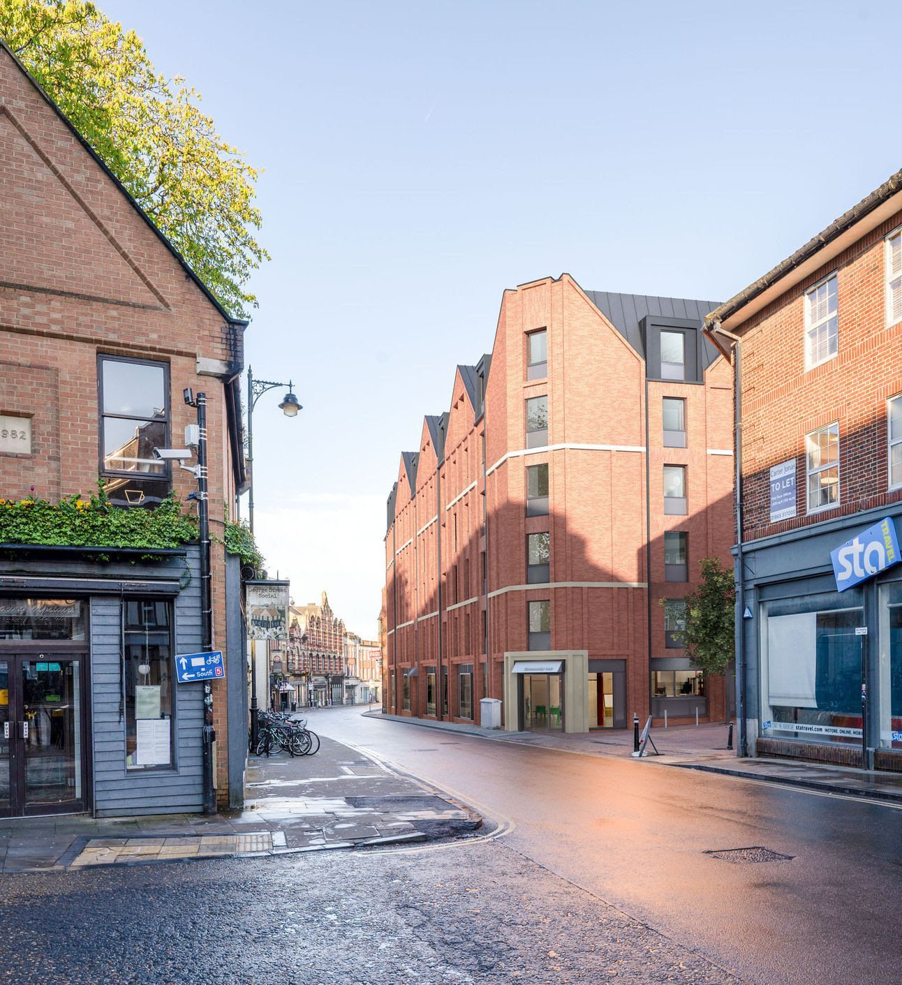
Eye-Level view for George Street, Marick © Blink Image Limited
Purpose: Show what it feels like to approach or interact with the development.
Best For: Both marketing and planning, as it represents how the project will look from the human perspective.
Considerations: These views are particularly effective in showcasing architectural detail and landscaping while helping to address concerns about visual impact.
Example: An eye-level image of a residential development demonstrates its minimal impact on nearby streets, easing concerns from local residents and planning authorities.
Internal Views
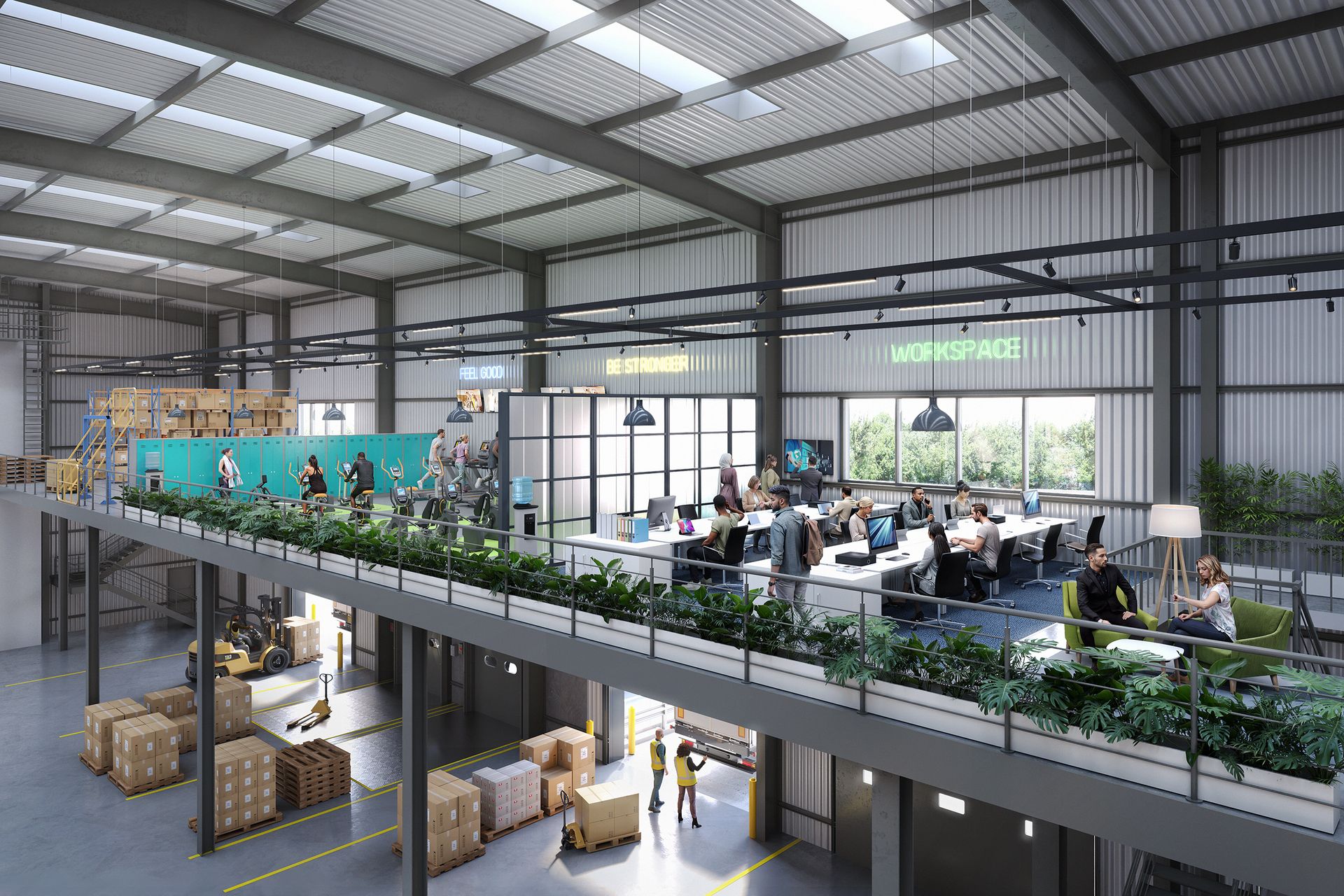
Showcasing versatile internal space, Prologis | © Blink Image Limited
Purpose: Allow stakeholders to visualise interior spaces and imagine themselves using them.
Best For: Marketing, especially for tenant or buyer engagement.
Considerations: These visuals aren’t necessary for planning but are crucial for showcasing the usability of the development’s interiors.
Example: An internal view of a large industrial unit showcases its spacious and flexible layout, helping prospective tenants imagine operating their business within the space.
The Bottom Line
By selecting the right perspectives, you can ensure every stakeholder sees your project in the best light. From aerial overviews that highlight scale to eye-level views that reassure communities, we create tailored visuals that help you achieve your goals.
Let’s talk about your next project. Get in touch today to discuss how we can help ensure you communicate your vision to the right audience.
[email protected] | 07777 146 495