- Seeing is Selling
- Posts
- The Dark Art of View Verification
The Dark Art of View Verification
What AVRs are, when your project needs one, and why the methodology has to be watertight
Ed Griffiths
March 06, 2026 • Estimated Reading Time: 3 minutes
Most planning imagery exists to make a scheme look compelling. Accurate Visual Representations exist for an entirely different reason. An AVR - sometimes called a verified view or photomontage - isn’t a creative choice. It’s a technical document.
Its job isn’t to sell the scheme. Its job is to prove, to a defensible standard, exactly what a development will look like from a specific point in the real world. That distinction matters more than most developers realise when they first encounter one - usually because a planning officer or statutory consultee has required it.
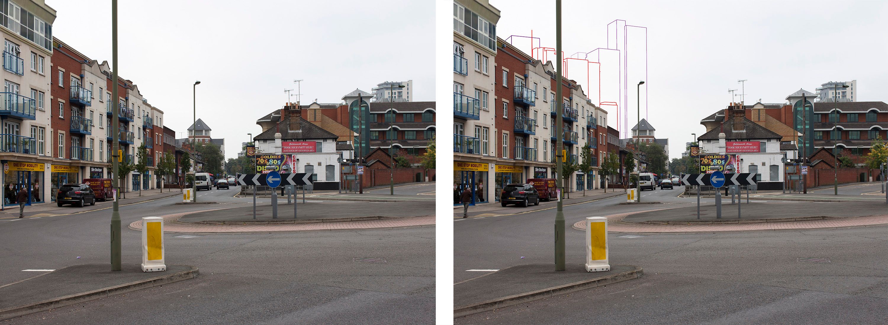
Technical Level 1 AVR showing before/after for a project in Woking
Not All Planning Images Are the Same
There’s a common assumption that a CGI is a CGI. It isn’t. A marketing visualisation is a creative interpretation - the lighting is chosen to flatter, the viewpoint selected to impress, the surrounding context presented sympathetically. That’s not a criticism. It’s the right tool for its purpose.
An AVR operates under an entirely different set of rules. The camera position is physically surveyed and documented. The lens focal length, time of year, and time of day are specified and verified against agreed guidance. The resulting image has to be defensible - to a planning officer, a landscape architect, a heritage body, or a member of the public who wants to know, with certainty, what they will see from a particular spot once the development is built. The image is only part of it. The methodology that underpins it matters just as much.
What the Process Actually Involves
AVRs are produced to different levels depending on what the application requires. A simple wireframe overlay can be sufficient to assess basic massing against a skyline. A fully rendered photomontage - matching photographic conditions with precision - is needed where the visual character of a scheme is under scrutiny or where public consultation demands a high degree of realism.
Whatever the level, the methodology is consistent: a precise survey of the agreed camera position, photography captured under specified conditions, a 3D model built to survey accuracy, and a verified composite accompanied by a technical note documenting every step. That technical note is the audit trail. It’s what allows an independent party to check the work - and it’s what gets challenged if the methodology is questioned at inquiry. This is not a process that can be compressed, and it is not one that rewards cutting corners.

The same project as above, but from over 5km away from an AONB
When Does a Project Need One?
The trigger is usually a scheme that sits in a sensitive setting, or one large enough to register on the skyline from a meaningful distance. Tall buildings in urban areas. Infrastructure crossing protected landscapes. Industrial development adjacent to settlement edges. Schemes affecting listed buildings, conservation areas, or nationally designated landscapes.
In over 20 years of producing AVRs, we’ve worked across almost every sector and scale - a footbridge in Hammersmith, high-rise residential in Woking, industrial units on grey sites, mixed-use schemes in town centres. Some viewpoints sit 200 metres from the development. Others are more than five kilometres away, where the question isn’t how the building looks up close, but whether it appears at all, and what it does to a horizon that people value. The technical demands at that distance are no less exacting than at close range.
A Design Tool, Not Just a Compliance One
AVRs are often thought of as a planning requirement to be discharged. The more useful way to think about them is as a design tool. Working iteratively with verified views - testing building heights, introducing planting or landform, adjusting massing - developers and landscape architects can use the process to identify and address visual impacts before they become objections. A scheme that has been genuinely designed around its AVRs tends to have a smoother planning process than one that commissions them at the end.
That kind of iterative work requires a partner who understands both the technical methodology and the design intent. It also requires experience - knowing which viewpoints are likely to matter, which consultees will scrutinise the methodology, and how to produce work that will hold up. It isn’t a task that suits studios without that depth of knowledge, regardless of how the images look on the surface.
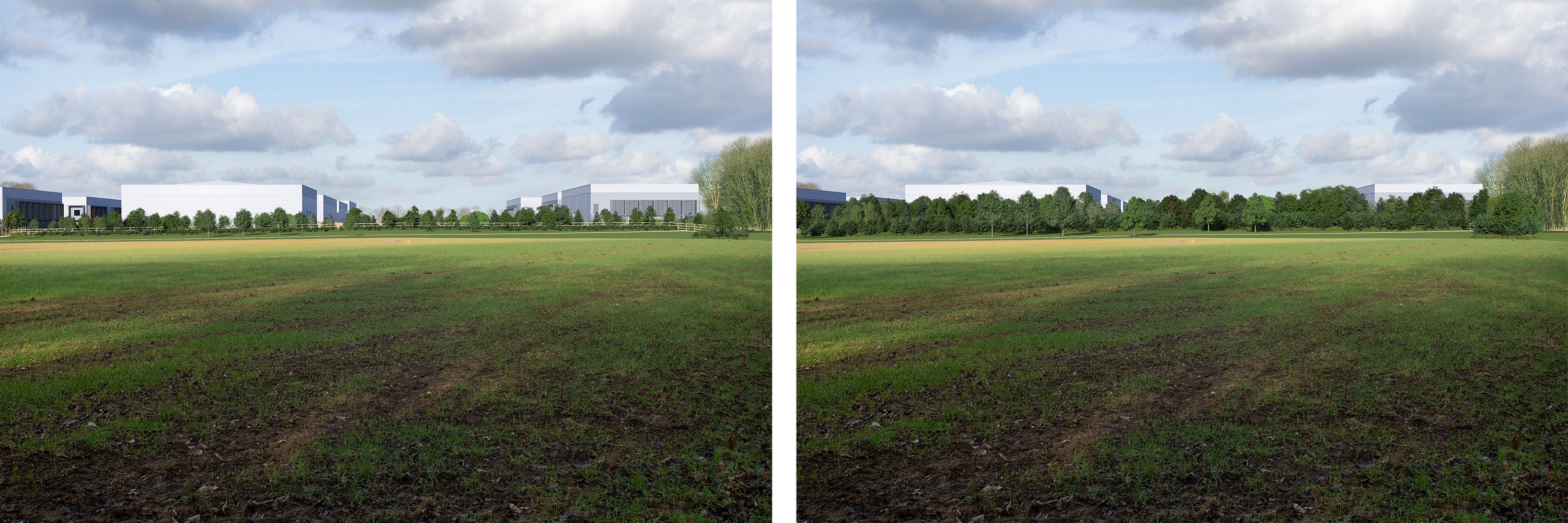
Another use case showing how planting changes things between year 1 and year 10
If a scheme could appear on a skyline, affect a listed building, or sit within a sensitive landscape, AVRs are likely to be required. Getting them right early can avoid expensive redesign or challenge later in the planning process. We’ve been producing verified views for over 20 years, across every sector and scale. We’d be glad to talk through what your project needs.
[email protected] | 07777 146 495